
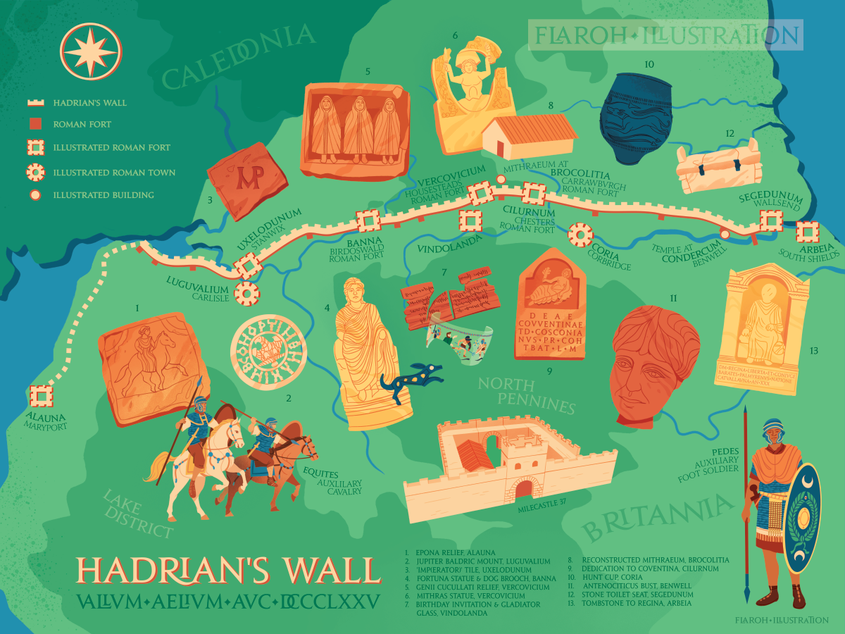
Hadrian’s Wall Illustrated Map
Digital, 2022
This map was created to celebrate the start of Hadrian’s Wall 1900, a year-long festival of its anniversary.
Hadrian’s wall was built along the northernmost border of Britannia in 122 CE. This map highlights various forts along the wall with illustrations of artefacts found on the sites. Read more on the research and creative process of this map.
If you are interested in purchasing this illustration as a print, it is now available now on my shop.